Geographic Information Systems
Arch 677, Spring 2025
New Jersey School of Architecture
Mon 6-8:50pm, WEST 140
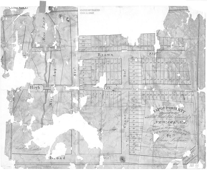
Figure 1: 1835 Property Map, Newark North Ward
Course Description
This course provides an introduction to the use of geographic information systems (GIS) methods for analyzing urban space, and the use of spatial data within the wider world of graphic communication techniques used by designers.
Maps and spatial analysis are key tools for interpreting the built environment and the social conditions that unfold within. GIS methods allow for the analysis of geographic features together with attributes (environmental, social, demographic, political) of those places.
The thoughtful use of spatial data can reveal previously unseen patterns, changing the way we see our world. Map-based approaches can transform the understanding of initial site conditions. However, maps are never just representations, they are nearly always active agents in shaping the worlds they describe. Geographic analysis can define the baseline of what is considered or excluded, what is possible, and what is not. Moreover, the constraints and limitations of software and data formats exert additional influence on how we are able to reason about and act upon the environment through planning and design.
This course engages with this agency of mapping directly in hands-on workshops covering the technical skills required to use maps as tools for research and design. Likewise, the course will focus throughout on fostering a deep understanding of the promises, as well as the limitations of GIS-based methods.
The class is organized in three major sections:
- Mapping Essentials. The first module in the course will introduce fundamental frameworks of GIS, ways of describing places with data including: defining location, spatial data types, projections and coordinate reference systems. the spatial concepts and techniques needed to analyze and represent relationships between places. We will also briefly cover spatial statistics and quantitative mapping, and geoprocessing methods useful for answering specific research questions.
- Maps Beyond Maps. We will explore advanced techniques for mapping over time, in three dimensions, and with interactivity. In addition we will cover ways of augmenting existing data sources with your own observations and annotations.
- Maps in Practice. Guest lectures and assigned readings will show a variety of approaches to the utilization of spatial data workflows within contemporary architecture, urban design and planning practice.
Learning Objectives
By the end of the course you should be able to:
- Use desktop GIS software to map and analyze urban environments
- Understand cartographic conventions and apply them in map-based drawings
- Integrate GIS software and data sources with commonly used modeling and imaging software, including Adobe Creative Suite & Rhino
- Develop and execute basic spatial research methodologies
- Adapt mapping techniques to specific design problems, informed by precedent research and supported by self-directed learning
Schedule Overview
| Date | Topic |
|---|---|
| 01/27 | the language of spatial data |
| 02/03 | projections and coordinate systems |
| 02/10 | map design I: audience, narrative and composition |
| 02/17 | map design II: style, details and symbology |
| 02/24 | mapping quantiative information |
| 03/03 | geoprocessing & research workflows |
| 03/10 | mid-semester Q&A, midterm exam |
| 03/17 | no class: spring recess |
| 03/31 | change in time, animation |
| 03/24 | 3D techniques with Rhino/Grasshopper |
| 04/07 | networked mapping: interactivity and web |
| 04/14 | making data, where does it come from, georeferencing and digitizing |
| 04/21 | tbd: guest lecture or project feedback |
| 04/28 | tbd: guest lecture or project feedback |
| 05/05 | FINAL CLASS: presentations |
Grading
Grades for the course will be determined as follows:
| Task | Points | Due |
|---|---|---|
| Attendance & Participation | 20 | |
| in-class questions and discussion responses | ||
| weekly lab exercise submissions | ||
| Midterm Exam | 40 | 03/10 |
| Map Portfolio | 40 | |
| share drafts of three maps for feedback | ||
| present revised maps | 05/05 | |
| submit final maps | 05/16 | |
| Total | 100 |
Required Materials & Other Resources
There are no required purchases of textbooks or other hard-copy materials. Short required and optional readings, available online or in PDF form, are assigned throughout the class as listed in the schedule. Juliana Maantay's GIS for the urban environment is recommended as an entrypoint to self-study beyond the scope of the class.
This syllabus and all personal information (attendance, grading etc.) will be distributed and collected through Canvas.
A separate class website at https://gis.carstenrod.in/ will be used to distribute readings, links, tutorials, and assignment briefs. Access to certain resources requires the username and password below:
| username | student |
| password | wholeearth |
Software, Languages and Tools Used
GIS is not a software. As such, proficiency in a specific Desktop software is intentionally omitted from the list of learning objectives.
Tutorial resources for this class will be provided for QGIS 3.34. This is a free, open-source software program for geographic analysis available for Windows, MacOS and Linux and is used widely in universities, nonprofits and smaller design firms. QGIS has very good documentation, and a training manual with good basic tutorials is also available.
ESRI ArcGIS Pro is another software tool for working with spatial information. This is commercial software with expensive licensing, but is common in government and corporate settings. Free or discounted student licenses may be available to you for independent study. ArcGIS tutorials published by ESRI can be provided in connection with relevant course topics on request.
Other commonly used tools include notebook-style software
for spatial data science applications, namely
RStudio for the R programming language (with sf and stars packages)
and JupyterLab for Python (with the geopandas and rasterio packages).
These tools are not covered in the course.
You may use either lab computers or your own laptop for in-class work. The assigned workload assumes all students have a personal device meeting their school's minimum specifications; you are expected to download and install QGIS before the start of the second class. Hardware issues (including room access) and software installation troubleshooting are not the responsibility of the instructor.
The use of professional 3D modeling and imaging software (Rhino, Grasshopper, Photoshop, Illustrator, and InDesign) is not required or covered in-depth but is highly encouraged for students in all design programs.
Instructor & Office Hours
Carsten Rodin (ccr25@njit.edu) is a designer and creative technologist with interests in urbanism, sustainability, housing design and spatial software (including websites, maps and games). He is a Zoning/Pre-Design Architect at FXCollaborative and previously worked for the NYC Department of City Planning.
Office hours are in-person Mondays 5-6pm or via Zoom at mutually agreeable times (please confirm availability, via email, 24 hours in advance).
Fine Print
The remainder of the syllabus covers university-required statements, policies on plagarism, attendance, and a brief land acknowledgement. Please review on your own time and contact the instructor with any questions or concerns.
Academic Integrity and AI
The NJSOA maintains that academic integrity and honesty are of paramount importance. It is your responsibility as a student and practitioner to fully understand what plagarism means and why it presents ethical and legal issues. In particular, it is essential that you make a habit of giving proper attribution to the work of others when it crosses paths with your own. All students must adhere to the University Code on Academic Integrity and the Code of Student Conduct and are responsible under those policies to uphold the integrity of NJIT by reporting any known violation of academic integrity. The identity of the student filing the report will remain anonymous.
This course has a zero-tolerance policy on cheating and plagiarism. Any occurrences of such behavior will result in serious consequences at the instructor's discretion, ranging from failure of the assignment in question to official disciplinary action by the department or Dean of Students.
Some of you may be experimenting with the use of AI tools (large language models, text-to-image models, and image-to-image models) in your work. While methodological innovation is highly encouraged, we must also be conscious that the value of commercial AI services is predicated on their ability to obfuscate the authorship and provenance of source data. This obfuscation makes proper attribution difficult and confuses our ability to participate intentionally in the social processes of knowledge production, research and design. Students wishing to engage with AI in this course should be prepared to provide a reasoned justification for its use in a particular context.
HCAD librarian Maya Gervits has assembled excellent resources for students use on using images, citing, and plagiarism.
NAAB Accreditation
The National Architectural Accrediting Board accredits NJIT’s architecture program. This course engages all six of the Shared Values outlined in the 2020 Conditions for Accreditation.
In addition to the overarching values and ethics of the university, the NJSoA is dedicated to optimism, diversity and solidarity, professional conduct, constructive evaluation and instruction, collaborative community, health and wellbeing, time management and school-life-work balance, respectful stewardship and space management, and well-rounded enrichment. The pedagogy of architecture and design is as complex as it is rewarding, and as dynamically evolving as the people who learn and teach it. This understanding resides at the core of the NJIT Learning and Teaching Culture Policy.
Attendance
Students are expected to attend all regularly scheduled classes.
NJSOA follows NJIT attendance guidelines while requesting instructors to customize a policy for the cohort they teach. Consider a general level of maturity when drafting an attendance policy This document states that all students “are expected to attend all regularly scheduled classes.”
Attendance should be logged in a manner transparent to each student. The best way to do this is to keep an accurate attendance log on Canvas. The Canvas attendance function creates a percentage outcome based on whether a student is Present or Absent. The function allows an instructor to customize how Lateness is counted. The overall percentage can then be applied to a portion of the engagement grade.
If documented absenteeism is affecting a student’s performance, the NJSOA strongly recommends issuing a mid-semester warning notice using the Canvas log as evidence. Be advised that if a student challenges a grade, and absenteeism was an issue, the appeals committee will request this log.
The NJSOA recommends that instructors require students to notify them prior to missing or being late for a class and provide sufficient cause for nonattendance.
Backups & Late Work
Successful completion of this class requires working iteratively, that is, incorporating feedback into previous work to continuously improve. You must regularly save and back up your materials! Loss of work due to computer malfunction is not a sufficient excuse for late work.
Device Use
During scheduled class time students will be expected to use their computers only to access course-related materials (GIS software, tutorial resources, class syllabus, readings and web search for troubleshooting or data procurement purposes). The format of this course means that minimizing/resisting external distractions from non-class related computing (social media usage, email, other work, online shopping etc) is challenging but a shared responsibility of all members of the class.
Disability Accommodations
Students with disabilities who may need disability-related accommodations for this course are encouraged to make an appointment to speak to the instructor at the start of the semester. A Letter of Accommodation Eligibility from the Office of Accessibility Resources & Services (OARS) authorizing your accommodations will be required. For further information and assistance please email oars@njit.edu or call 973-596-5417.
Email & Troubleshooting
Students should not rely on or expect an immediate response to questions sent via email to the instructor. Please begin assignments with enough time to attend office hours or ask a question several days before the assignment is due.
Learning how to troubleshoot technical issues and locate relevant resources is crucial in your long-term success with GIS methods. With this in mind, emails with technical questions must at a minimum contain the following:
- a clear description of what you are trying to do, and what the problem is
- a summary of the steps you have already taken to address the issue
- screenshots (where applicable) that help to explain the problem
- a link to at least one website you consulted for assistance with the issue before writing the email. The QGIS docs are a good starting place as is GIS Stack Exchange.
Troubleshooting email missing these steps will be respectfully returned with a request for elaboration.
Grading Standards & Language
NJSOA grading standards for graduate courses are as follows:
| A | 4.0 | Excellent |
| B+ | 3.5 | Good |
| B | 3.0 | Acceptable |
| C+ | 2.5 | Marginal Performance |
| C | 2.0 | Minimum Performance |
| F | 0.0 | Failure |
| † AUD, I, W, S, U | Audit, Incomplete, Withdrawal, Satisfactory, Unsatisfactory |
† consult advisor and/or registrar for details
Land and Labor Acknowledgement
We meet on the ancestral land of the Lenape People, and acknowledge the presence of Indigenous people past, present, and future. We respectfully acknowledge our debt to the enslaved people, primarily of African descent, whose labor and suffering built and grew the economy and infrastructure of a nation that refused to recognize their humanity. We acknowledge all those who have been historically and systemically disenfranchised by the very same constructs of language, measurement, delineation and property that we will confront here in class and elsewhere.